

What Should You Test After an ArcGIS Update? A GIS Regression Testing Checklist
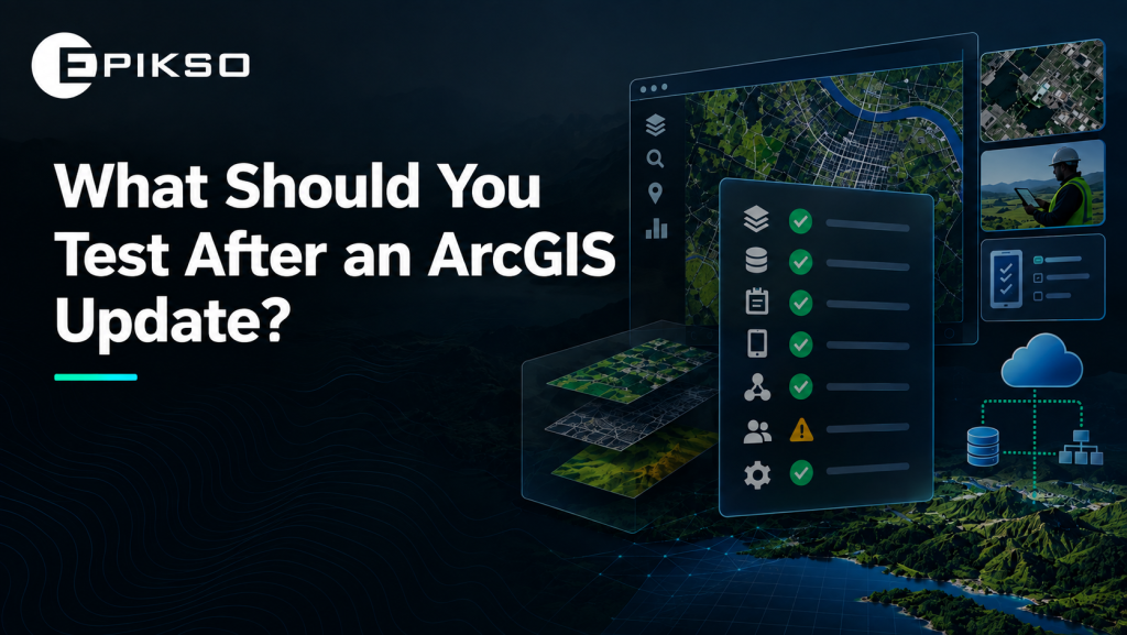
What Should You Test After an ArcGIS Update?
An ArcGIS update can install successfully and still affect the workflows your teams rely on.
Field Maps forms may behave differently. Survey123 logic can break. Domains, integrations, permissions, or Utility Network workflows may no longer work as expected.
That is why ArcGIS regression testing is important after an update. Update testing confirms that the update itself was completed successfully, while regression testing verifies that existing functionality still works after the change.
In GIS, that means validating not only individual applications, but also the workflows and dependencies connecting them.
The real question is:
Do the workflows your teams rely on still work as expected after the update?
1. Test Critical Workflows First
A practical GIS QA checklist should begin with the workflows that would create the greatest operational impact if they failed.
Examples include:
- Field inspections
- Asset updates
- Work orders
- Data collection
- Utility tracing
- Offline workflows
- Reporting
Prioritize the workflows your teams use every day rather than trying to test every possible scenario.
This risk-based approach helps make ArcGIS update testing more focused and manageable.
2. Validate Field Maps and Survey123
Field Maps Testing
For Field Maps testing, validate:
- Forms and editing
- Domains and required fields
- Attachments
- GPS capture
- Offline areas
- Sync
Offline workflows deserve particular attention because maps, layers, tables, and other content must be correctly configured for offline use.
Survey123 Testing
For Survey123 testing, validate:
- Required questions
- Calculations
- Conditional logic and visibility rules
- Choice lists
- Attachments
- Submissions
Survey123 supports calculations, validation rules, required questions, visibility logic, and multiple question types, making these important areas to verify after changes.
The goal is to test the complete user workflow, not simply confirm that the application opens.
3. Check Data Rules and Utility Network
Updates and configuration changes can also affect data quality and network behavior.
Validate:
- Domains
- Subtypes
- Contingent values
- Attribute rules
- Relationships
- Connectivity
- Traces
- Network topology
- Network rules
- Associations
- Subnetwork management
- Named trace configurations
Contingent values, for example, help control valid combinations of attribute values and support data integrity across GIS datasets.
For organizations using Utility Network, Utility Network upgrade testing should include topology, associations, subnetworks, and tracing workflows. Network topology is particularly important because traces depend on current topology and can produce inaccurate results when affected areas have not been validated.
Small changes at the data level can create issues across multiple applications.
4. Test Integrations and Permissions
GIS environments often connect with other enterprise systems.
After an update, verify:
- APIs and integrations
- Authentication
- Data exchange
- User roles
- Editing permissions
- Application access
Testing only with an administrator account can hide problems that actual users may experience.
ArcGIS Enterprise upgrades can also involve dependencies across Portal for ArcGIS, ArcGIS Server, Web Adaptor, Data Store, federated servers, geodatabases, and other components, so compatibility and configuration should be reviewed as part of the testing process.
5. Test the Full Workflow
Individual applications may work correctly while the complete business process does not.
Test the same sequence your users follow:
Capture → Validate → Submit → Sync → Process → Report
This end-to-end approach helps identify issues that only appear when multiple applications, services, roles, and integrations interact.
When Manual Testing Becomes Difficult to Scale
As GIS environments grow, teams may need to repeatedly test more applications, forms, devices, roles, integrations, and workflows after every update or configuration change.
This is where GIS test automation can help.
Automated regression testing allows teams to repeatedly validate critical workflows and identify issues earlier without manually repeating the same test scenarios after every release.
In one Epikso engagement, a unified QA automation framework reduced regression testing from 9 days to approximately 30 minutes while helping protect 15+ ArcGIS programs.
Automation does not eliminate the need for QA. Instead, it allows GIS teams to focus manual testing on new functionality, complex scenarios, and higher-risk workflows while repeatable regression tests are executed more consistently.
Is Your GIS Environment Ready for Its Next Update?
If your team is manually retesting the same GIS workflows after every ArcGIS update or configuration change, there may be an opportunity to simplify the process.
Talk with Epikso about your current GIS QA process and identify which ArcGIS workflows could be automated first.
References
- Esri — Upgrade ArcGIS Enterprise. Guidance on ArcGIS Enterprise upgrade order, compatibility, backups, geodatabases, and upgrade considerations.
- Esri — ArcGIS Field Maps: Configure the Map. Documentation covering offline configuration and requirements for maps, layers, and related content.
- Esri — ArcGIS Survey123 Web Designer Essentials. Documentation covering calculations, required questions, validation, visibility rules, choice lists, and survey behavior.
- Esri — ArcGIS Pro Utility Network Documentation. Guidance covering network topology, traces, associations, subnetworks, and other Utility Network workflows.
- Esri — Contingent Values. Documentation explaining how contingent values help enforce valid combinations and improve GIS data integrity.
- Epikso — QA Automation for ArcGIS Field Workflows. Overview of QA automation approaches for improving data reliability across ArcGIS field workflows.
- Epik Solutions — Unified Web & Mobile QA Automation for ArcGIS. Published Epikso results documenting the reduction of regression testing from 9 days to approximately 30 minutes and support for 15+ ArcGIS programs.
Ensuring Reliability with Esri’s Survey123 Fail-Safe Features

Nearshoring in Mexico 2025: The Smart Move for IT and Digital Transformation

The Power of Large Language Models: A Quick Guide
About Author

David Miller
Digital marketing consultant with 15+ years' experience. Primarily focused on consulting companies on their digital presence while helping them grow technology for attribution and advertising. Worked with brands and created product roadmaps, created and managed multivariate testing, performed site optimization to increase organic traffic, improved conversion rate on e-commerce sites, and created monetization plans for the largest business websites in the US.